
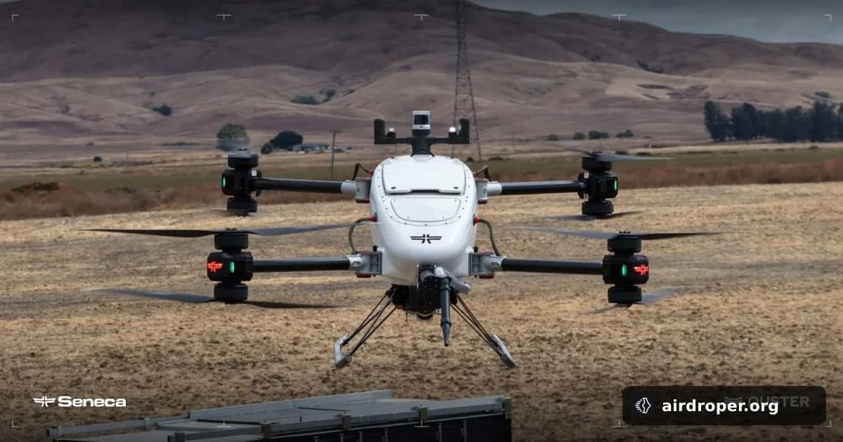
Wildfire Drones Gain Sharper 3D Vision
Why wildfire drones need better sensing
Wildfires are among the toughest environments for autonomous aircraft. Smoke can reduce camera visibility, the ground can shift quickly, and payload-heavy drones have very little margin for error. In that setting, reliable spatial awareness is not a luxury — it is a core requirement for safe operation.
What the new partnership brings
Ouster and Seneca are working together to improve how autonomous wildfire-response drones see the world around them. The focus is on 3D lidar, which can give a drone a more complete picture of nearby terrain and obstacles when visual conditions are poor.
That matters because wildfire missions are not just about spotting flames. A drone must understand where it is in relation to trees, slopes, debris, and other hazards. Better perception can support safer flight paths and more stable autonomy in a fast-changing environment.
Why 3D perception matters in firefighting
On wildfire operations, drones can be used for scouting, situational awareness, and support for teams on the ground. The more accurately an aircraft can interpret its surroundings, the more useful it becomes during a mission where smoke and heat can make direct human assessment difficult.
Lidar does not replace onboard cameras, but it complements them. Together, the two can provide a stronger view of the environment than either sensor alone. For an autonomous platform, that combination can help bridge the gap when optical systems struggle.
A sign of where the market is going
Emergency-response UAVs are moving beyond basic remote observation and toward more capable autonomous workflows. Wildfire missions are a clear example of why sensor quality matters: the environment is unpredictable, visibility can collapse without warning, and the aircraft still has to make reliable decisions.
This is where perception technology becomes central to drone design. As demanding missions expand, the industry is placing more weight on onboard sensing and real-time data processing. For wildfire drones, that shift can make the difference between a risky flight and a mission that can be completed with greater confidence.
Related Posts

Comments
Sign in to leave a comment