UgCS 6.3 Adds Terrain Following for LiDAR Surveys
UgCS 6.3: more control for demanding LiDAR missions
Planning a drone survey over a large area is never just about drawing a route. For LiDAR work, the mission also has to account for sensor settings, calibration steps, and consistent flight behavior across the entire site. SPH Engineering’s UgCS 6.3 update is aimed at making that process easier to manage.
What’s new in version 6.3
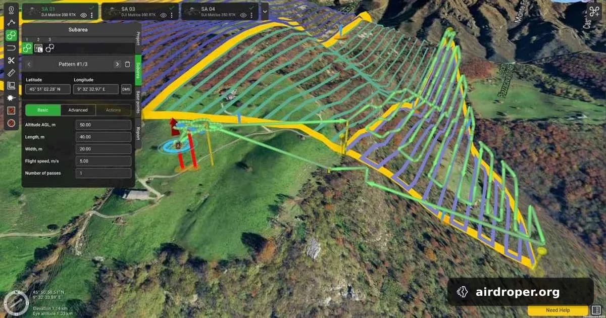
The headline feature is terrain-following control for complex missions. In practical terms, this helps the aircraft maintain a more consistent height above ground while flying over uneven terrain. That matters in LiDAR operations, where data quality depends heavily on keeping survey parameters stable from start to finish.
The update is geared toward large-area missions and environments with changing relief. In those cases, mission planning is not only about waypoints and coverage — it also has to reflect how the drone will respond to terrain variation along the route.
Why this matters for survey teams
Operators working in mapping or inspection usually need a workflow that keeps multiple mission elements aligned. That means:
- maintaining a consistent flight profile across the site;
- matching sensor settings to the planned route;
- reducing manual adjustments during execution;
- lowering the risk of mission-planning errors.
Tools that combine route planning with terrain-aware flight behavior can make that workflow more manageable.
Operational value
For LiDAR surveys, flight stability is as important as the sensor itself. If the drone can better follow the planned height above ground, operators have a better chance of getting predictable results and avoiding unnecessary repeat passes. That can simplify mission preparation and make large projects easier to execute.
Market context
Updates like UgCS 6.3 point to a broader trend in professional drone software: more automation, more terrain awareness, and tighter integration between mission planning and field execution. For industrial and geospatial applications, the software is increasingly expected to handle the drone, the sensor, and the environment as one workflow.
Related Posts
Comments
Sign in to leave a comment